
")
Post Summary – hikes in the smokies
There’s nothing like hiking through the Smokies—sunlight filtering through the trees, the sound of waterfalls in the distance, and views that stretch for miles. Whether you’re out for a short, peaceful stroll or chasing high-elevation views that leave your legs burning and your heart full, these are some of the best hikes in the Smoky Mountains to add to your bucket list.
Want to keep the adventure going? I’ll have posts coming soon all about the best scenic drives, cozy cabins to crash in, and where to eat after a day on the trails. Stay tuned!
SEE ALSO: What to Pack When Hiking
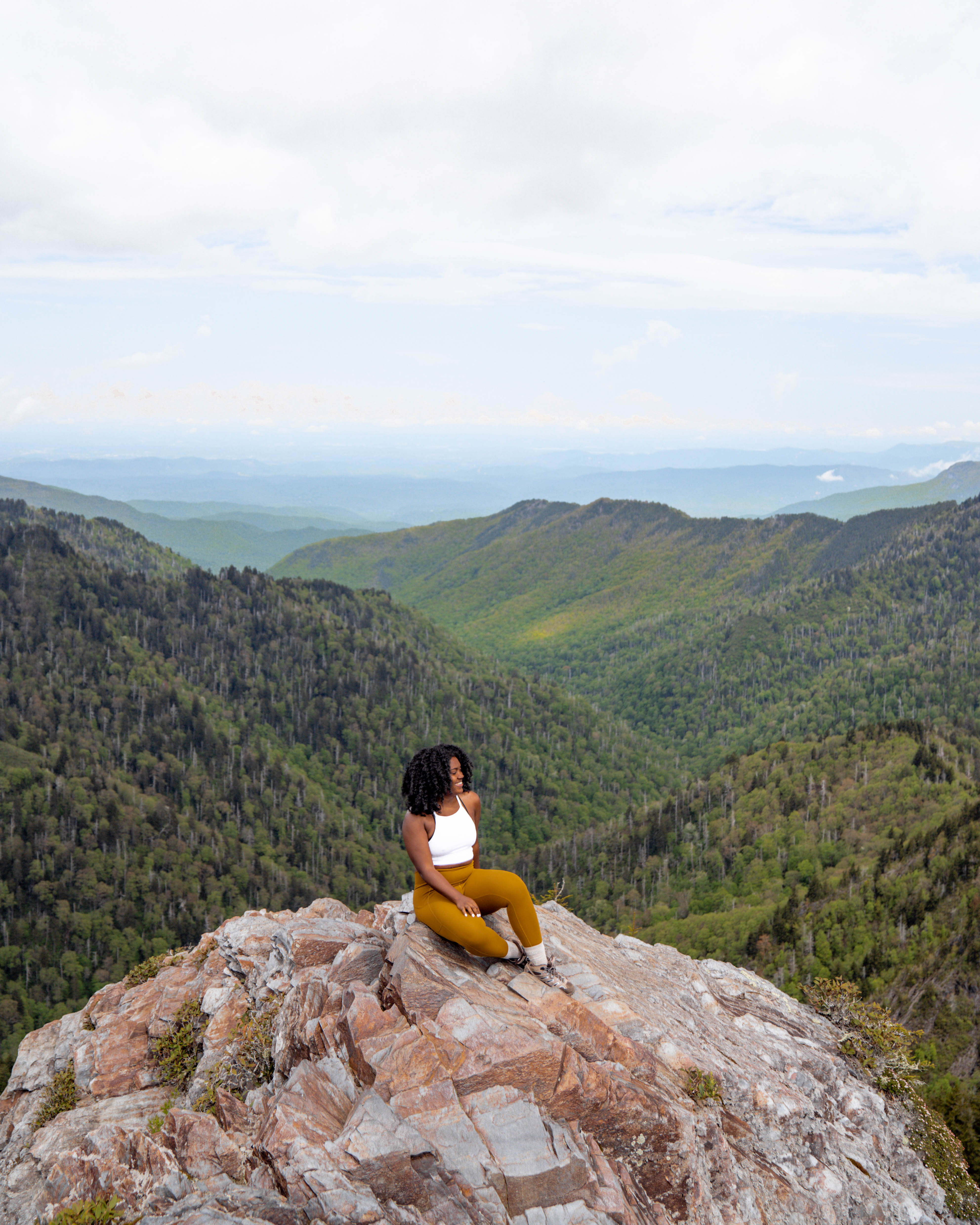
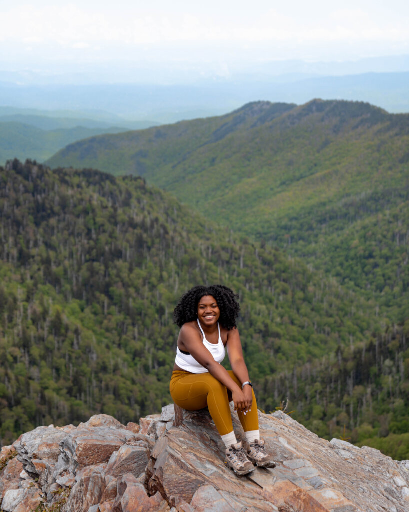
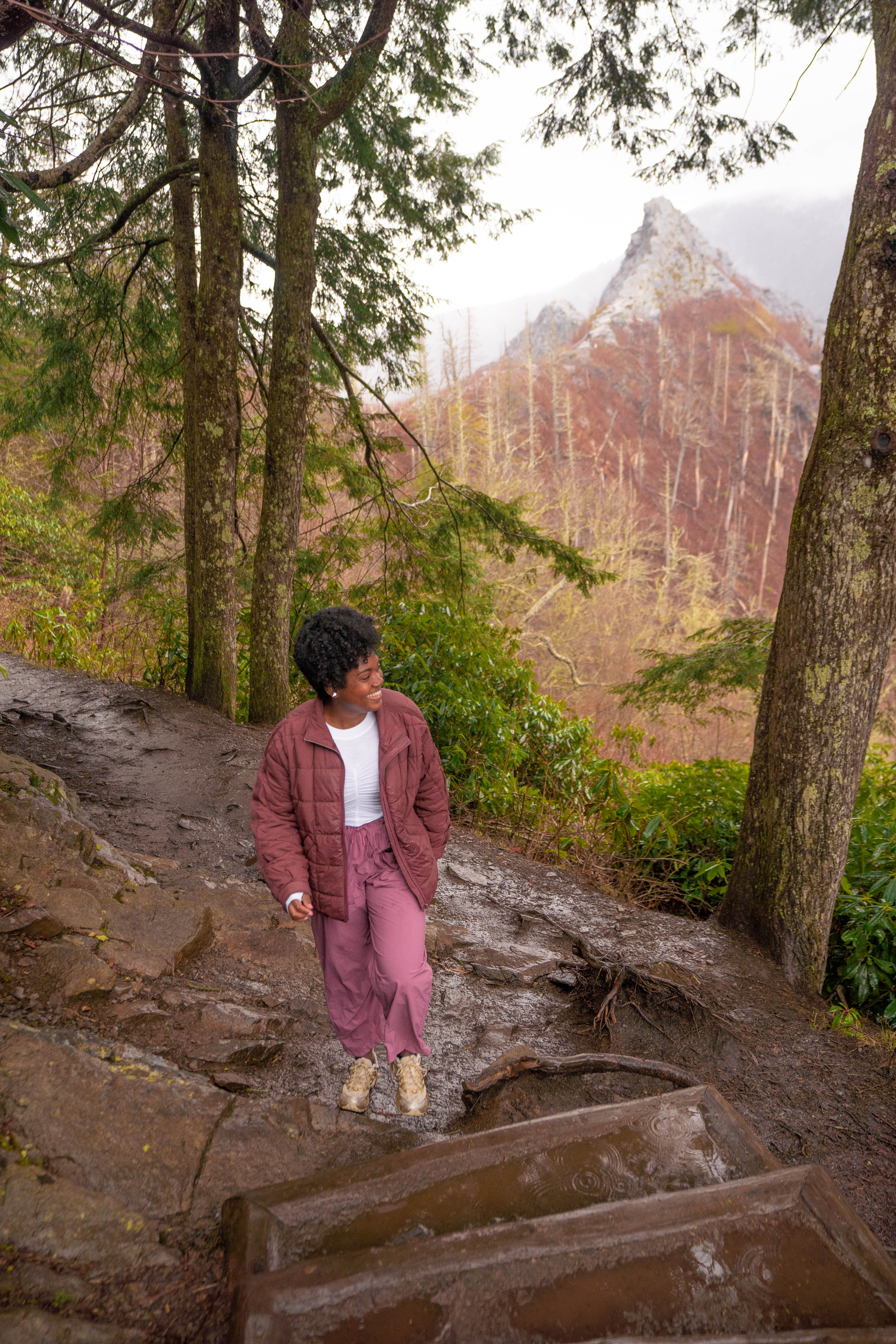
1. Charlies Bunion
- Length: 8.0 miles out and back
- Elevation Gain: 1,886 feet
- Difficulty: Moderate to strenuous
- Alltrail link: https://www.alltrails.com/trail/us/tennessee/charlies-bunion-via-appalachian-trail
Charlies Bunion might just be one of the best-kept secrets in the Smokies—and easily one of the best hikes in the Smokies if you’re craving big views without the crowds. Located off the Appalachian Trail, this 8-mile out-and-back hike starts at Newfound Gap and serves up jaw-dropping views of rugged cliffs, dramatic ridgelines, and layers of mountains that seem to stretch on forever.
Charlies Bunion is an 8‑mile (12.9 km) round‑trip hike along the iconic Appalachian Trail from Newfound Gap, gaining about 1,640 feet in elevation—making it moderately strenuous but hugely rewarding. After the first couple of miles of steady climb through dense spruce‑fir and hardwood forests, occasional clearings offer early glimpses of Mount LeConte and the North Carolina high country.
At around 2.7 miles, you’ll pass the Boulevard Trail junction (to Mount LeConte) and the Icewater Spring shelter, before cresting a narrow ridge with sweeping vistas. The final short spur takes you to the famous rock outcrop of Charlies Bunion—part of the rugged Anakeesta Formation—with breathtaking 270° views of peaks like LeConte, Kephart, and Guyot.
This trail is considered one of the best day hikes in the Great Smoky Mountains National Park, offering epic scenery without a massive time commitment. It’s a moderate-to-challenging hike, but totally worth it. You’ll feel like you’re on the edge of the world—without the crowds you’ll find on more popular trails.
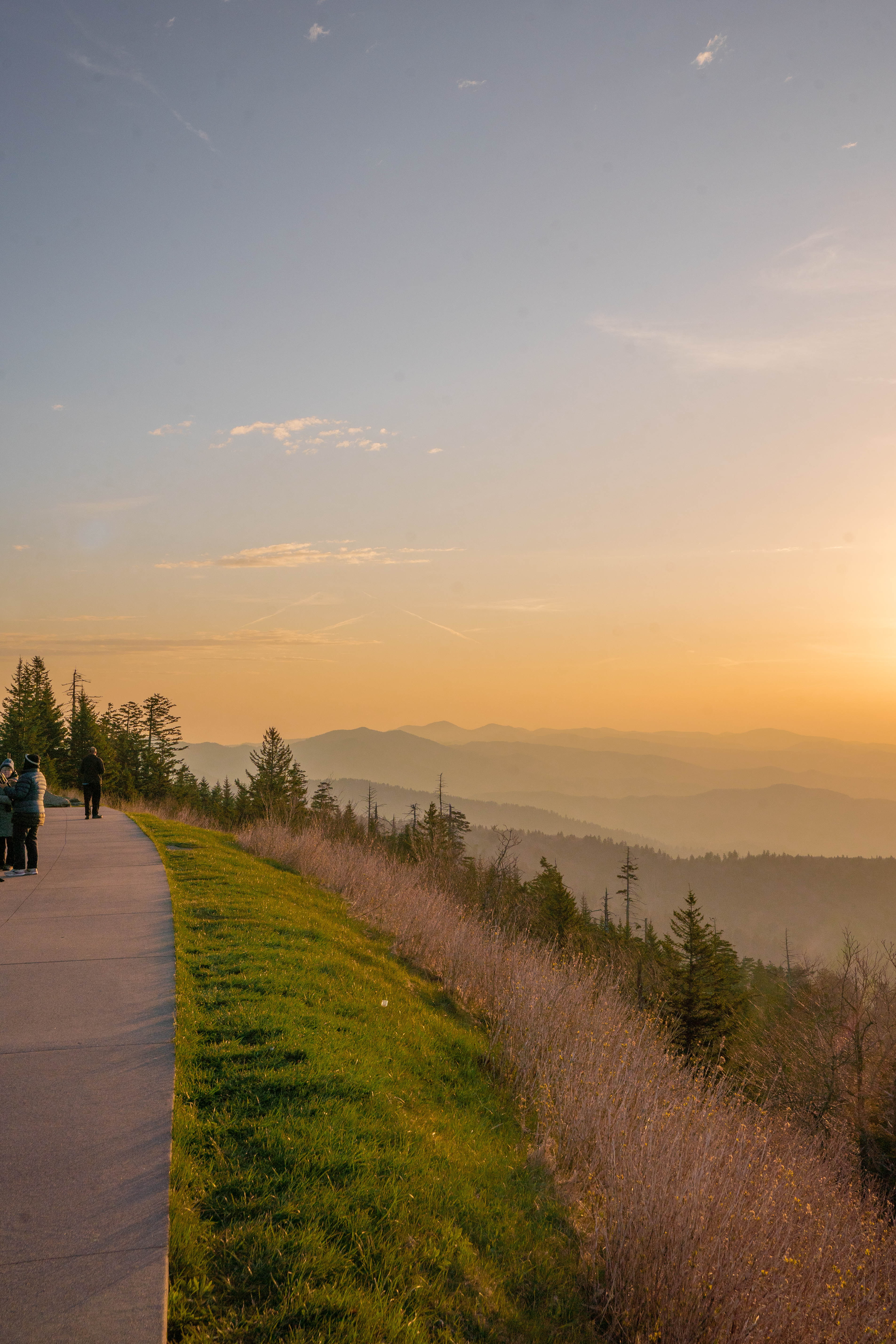
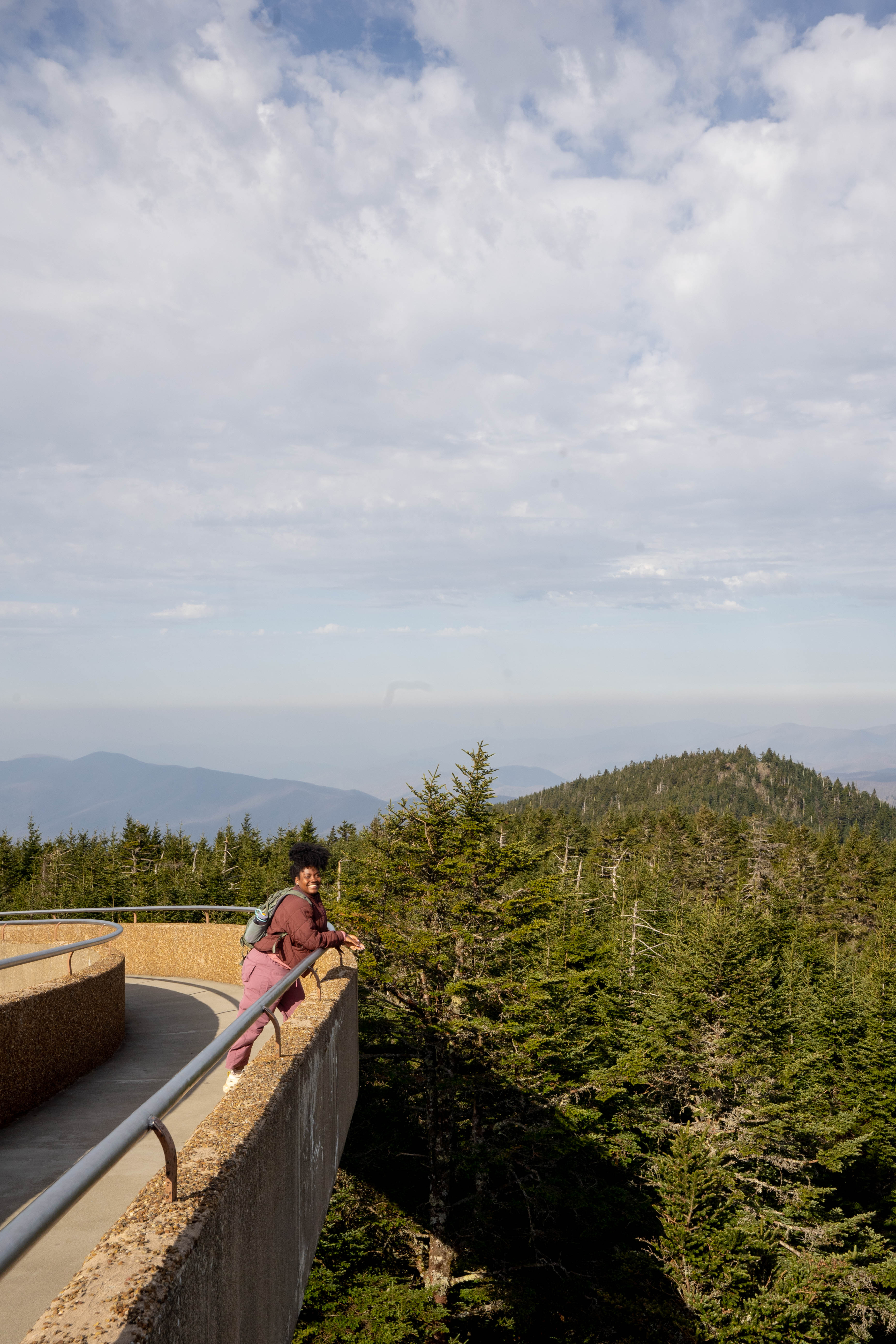
2. Kuwohi Trail (formerly known as Clingmans Dome)
- Length: 1.3 miles round trip
- Elevation Gain: 337 feet
- Trail Type: Moderate
- Alltrails link: https://www.alltrails.com/trail/us/north-carolina/forney-ridge-trail-to-clingmans-dome-loop?
Kuwohi Trail (previously known as Clingmans Dome) at 6,643 feet is the highest point in Great Smoky Mountains National Park and the entire state of Tennessee—making it a must‑visit landmark in the Smokies. Accessible via a 7‑mile climb from Newfound Gap Road, you’ll reach a large parking lot just 0.5 mile below the summit.
From the lot, a short but steep paved trail leads to a circular concrete observation tower built in 1959. The spiral ramp climbs at about a 12% grade—so while it’s less than a mile round‑trip, it’s a heart‑pumping ascent more than a stroll.
The payoff? A panoramic 360° view that, on clear days, stretches across seven states and up to 100 miles, though haze often limits visibility to around 20 miles.
As you climb through the high‑elevation, the temperatures drop by 10–20°F compared to the lowlands—so layers are key, even during summer in the Great Smokies. Once you’re at the summit, the dramatic views—especially at sunrise or in fall, when fog drapes the ridgelines or leaves blaze color—are unforgettable.
Kuwohi Trail (Clingmans Dome) may be short, but it’s easily one of the best hikes in the Smokies for panoramic views with minimal effort. It’s perfect for travelers or day‑hikers who want epic scenic reward without committing to a long backcountry trek.
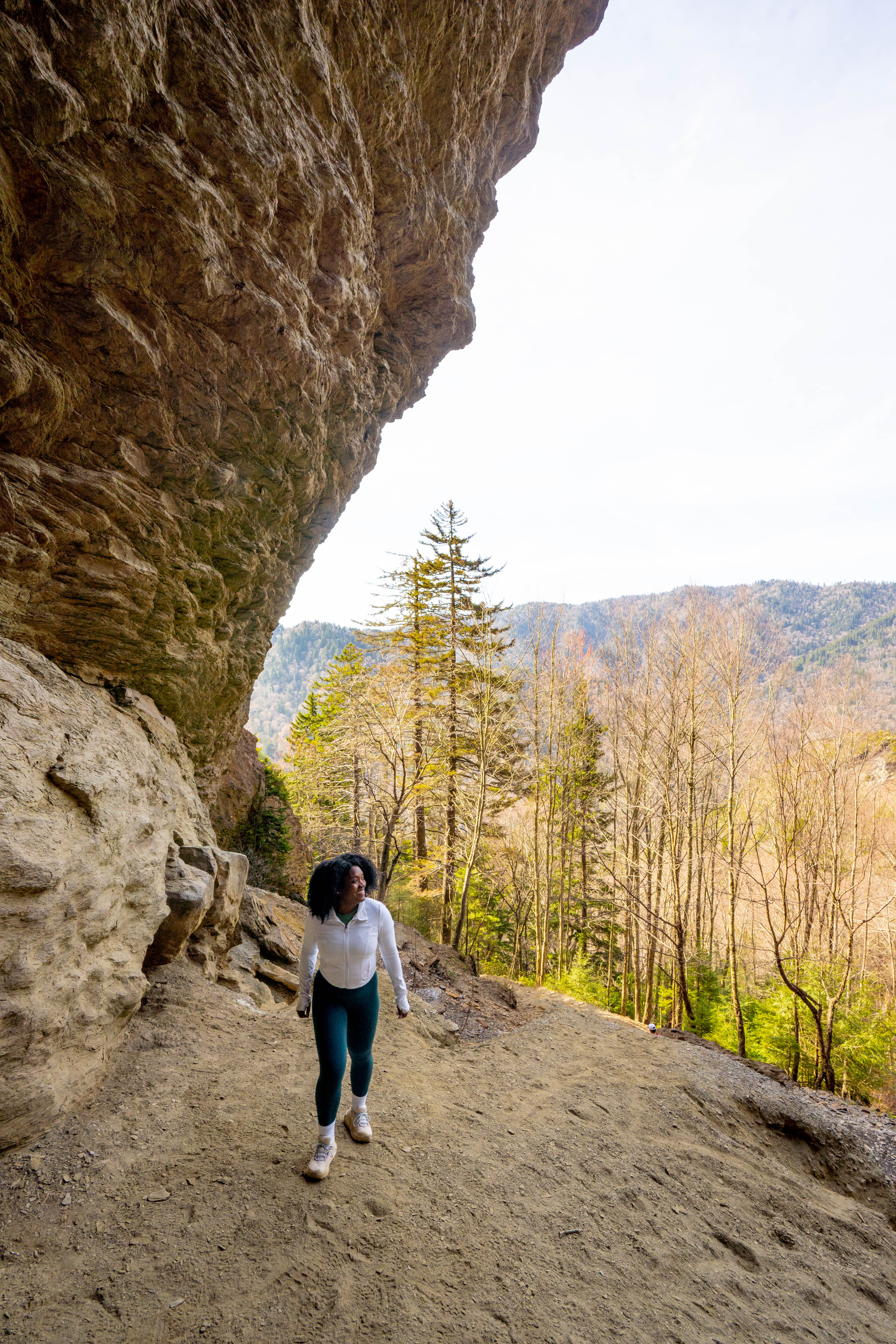
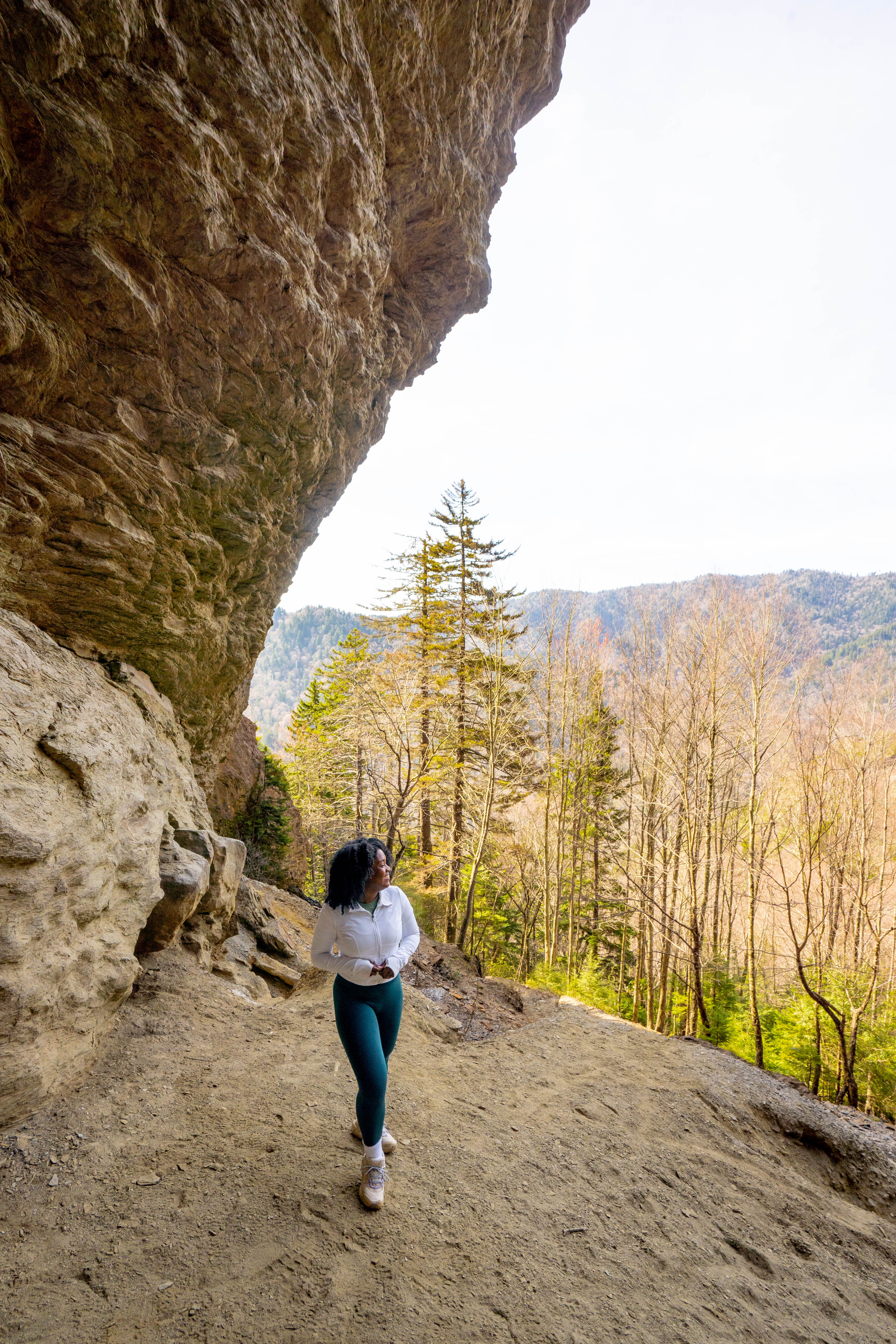
3. Alum Cave Trail to Mount Le Conte
- Length: 11 miles round trip (to summit)
- Elevation Gain: 3,077 feet
- Trail Type: Strenuous
- AllTrails Link: https://www.alltrails.com/trail/us/tennessee/alum-cave-trail-to-mount-leconte
Alum Cave Trail is one of the best hikes in the Smokies and the most scenic way to reach Mount Le Conte. This 5‑mile round‑trip hike (about 2,700 ft of elevation gain) takes you from Newfound Gap Road through the forest, along Alum Cave Creek, and across rustic log bridges before arriving at multiple memorable landmarks.
You’ll pass through the iconic Arch Rock (~1.3 mi in), walking beneath a natural slate arch via carved stone steps and cables. Soon after, you’ll hit Inspiration Point (~2 mi)—a heath bald offering panoramic views toward Little Duck Hawk Ridge and Myrtle Point. At about 2.2 miles, you’ll reach Alum Cave Bluff, an 80‑ft concave sandstone overhang that makes a cool rest stop—and great photo opp.
If you’re up for a challenge, continue past Alum Cave Bluff to summit Mount Le Conte, one of the most iconic peaks in the Smokies at 6,593 feet. The trail gets steeper and more rugged after the bluff, with narrow ledges, cable handrails, and switchbacks as you gain elevation.
It’s about 5 miles one way to the top—making it a 10-mile round-trip—but the changing scenery and sense of adventure make every step worth it. As you climb, you’ll pass through a high-elevation spruce-fir forest before reaching the legendary LeConte Lodge, the highest guest lodge in the Eastern U.S.
From there, you can head to nearby viewpoints like Cliff Tops or Myrtle Point for jaw-dropping panoramic views, especially at sunrise or sunset. If you’re looking for a full-day adventure with serious rewards, the Alum Cave Trail to Mount Le Conte is one of the best hikes in Great Smoky Mountains National Park.
4. Andrews Bald
- Length: 3.6 miles round trip
- Elevation Gain: 875 feet
- Trail Type: Moderate
- Alltrails: https://www.alltrails.com/trail/us/north-carolina/andrews-bald-trail
Andrews Bald is a standout hike in the Smokies. It’s a moderate 3.5 mile round‑trip hike along the Forney Ridge Trail, starting just south of Kuwohi (formerly Clingmans Dome). With roughly 900 feet of elevation gain, it strikes the perfect balance of accessibility and reward.
You’ll begin the trail from the far end of the Kuwohi parking lot, and within the first tenth of a mile are stairs and forks: stay left at the Kuwohi Bypass to remain on Forney Ridge Trail.
About a mile in, the trail begins a gradual uphill stretch before leveling out as you approach Andrews Bald, arriving at roughly 1.7–1.8 miles from the trailhead. Once you step onto the bald, you’re greeted by a sweeping grassy meadow, the highest maintained bald in the Smokies at 5,920 ft.
You’ll have panoramic views across the southern Smoky Mountains and, on clear days, a distant view of Fontana Lake. The trail is especially popular in late spring, when flame azaleas and Catawba rhododendrons burst into bloom—making it one of the best hikes in the Smokies during wildflower season.
5. Rainbow Falls Trail
- Length: 5.1 miles round trip
- Elevation Gain: 1,594 feet
- Trail Type: Moderate to strenuous
- Alltrails link: https://www.alltrails.com/trail/us/tennessee/rainbow-falls-trail
Rainbow Falls Trail is a moderately‑strenuous hike in the Smokies that leads to the tallest single‑drop waterfall in the national park—and all within a 5.4 mile round‑trip (about 1,685 feet of elevation gain). Starting along Roaring Fork near Gatlinburg, the trail immediately climbs through a boulder-strewn section alongside LeConte Creek.
At roughly 2.6–2.7 miles in, you’ll reach Rainbow Falls, an awe‑inspiring 80‑foot waterfall where misty spray often creates a rainbow on sunny afternoons—hence its name. From here, many hikers turn back, but the trail continues upward for another 4 miles toward Mount Le Conte, passing scenic rock outcroppings like Rocky Spur at around mile 5.4.
The full trek to the summit and LeConte Lodge is roughly 13 miles round‑trip with nearly 4,000 feet of elevation gain—a challenging but deeply rewarding adventure that’s often ranked among the best hikes in the Smokies for its scenery and waterfall highlight.
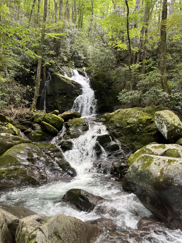
6. Mouse Creek Falls
- Length: 5.1 miles round trip
- Elevation Gain: 605 feet
- Trail Type: Moderate to strenuous
- Alltrails link: https://www.alltrails.com/trail/us/north-carolina/mouse-creek-falls-via-big-creek-trail
Mouse Creek Falls is a serene 4‑mile round‑trip hike along the Big Creek Trail in the eastern section of Great Smoky Mountains National Park, offering approximately 605 feet of elevation gain. It’s often considered one of the best hikes in the Smokies for families, beginners, and seasoned visitors alike.
Roughly 1.5 miles in, you’ll pass Midnight Hole, a dramatic emerald-green pool beneath a small waterfall, an enchanting swimming spot hidden amid boulders and rhododendron. Continue for another half‑mile, and a discreet side trail (marked by a hitching post) leads you to Mouse Creek Falls, a stunning 45-foot, two-tier cascade.
This is where Mouse Creek plunges into Big Creek across moss-covered rock faces—an ideal place to pause, breathe, and enjoy the view.
This hike typically takes between 2–3 hours and feels surprisingly gentle despite the mountainous setting. The well-maintained path, creekside ambiance, and peaceful waterfall destination make it a standout half‑day escape in the Smokies.
SEE ALSO: What to Wear Hiking in Summer
7. Gregory Bald
- Length: 11.3 miles round trip
- Elevation Gain: ~3,000 feet
- Trail Type: Strenuous
- Alltrails link: https://www.alltrails.com/trail/us/tennessee/gregory-ridge-trail-to-gregory-bald
Gregory Bald is a hike that feels like a true photo, especially in June when the flame azaleas are in full bloom and the mountaintop comes alive in fiery shades of orange, pink, and coral. It’s a bit of a challenge, but so worth it.
The most popular route is the Gregory Ridge Trail, a steady 11.3-mile round-trip with about 3,000 feet of elevation gain. You’ll start in a quiet, wooded forest, cross a few wooden footbridges, and climb through shaded switchbacks before popping out onto the bald—a wide open meadow sitting at nearly 5,000 feet.
From the top, you’ll catch panoramic views of Cades Cove, Fontana Lake, and ridge after ridge fading into the distance. It’s stunning any time of year, but the bloom season in mid-to-late June is the most photogenic timeframe to visit. The colorful wild azaleas only grow in a few places, and Gregory Bald is one of the best spots in the world to see them.
If you’re looking for a full-day hike with big payoffs, sweeping views, and a bloom that’ll stop you in your tracks, Gregory Bald easily ranks among the best hikes in the Smokies and deserves a spot on your bucket list.
8. Mount Cammerer via Low Gap Trail
- Length: 11.2 miles round trip
- Elevation Gain: 3,149 feet
- Trail Type: Strenuous
- Alltrails link: https://www.alltrails.com/trail/us/tennessee/mount-cammerer-via-low-gap-trail
Mount Cammerer via the Low Gap Trail is one of the most rewarding—and challenging—day hikes in the Smokies. The hike begins at Cosby Campground and climbs steeply for about 3 miles, gaining over 2,000 feet in elevation.
It connects with the Appalachian Trail, then follows a scenic ridge for about 2 more miles toward the summit. A short but rocky side trail leads to the top, adding a little extra challenge before the reward.
At the summit, you’ll find a unique stone fire lookout built by the Civilian Conservation Corps in the 1930s. This rugged structure sits into the rocks, with a wraparound deck and big windows offering 360° Smoky Mountain views.
On clear days, you can see for miles over valleys, ridgelines, and peaks like Mount Sterling. The full hike is about 11 miles round-trip, with 3,000+ feet of elevation gain, but the summit makes it unforgettable.
The trail shines in fall for its colorful foliage, and in early spring for blooming wildflowers.
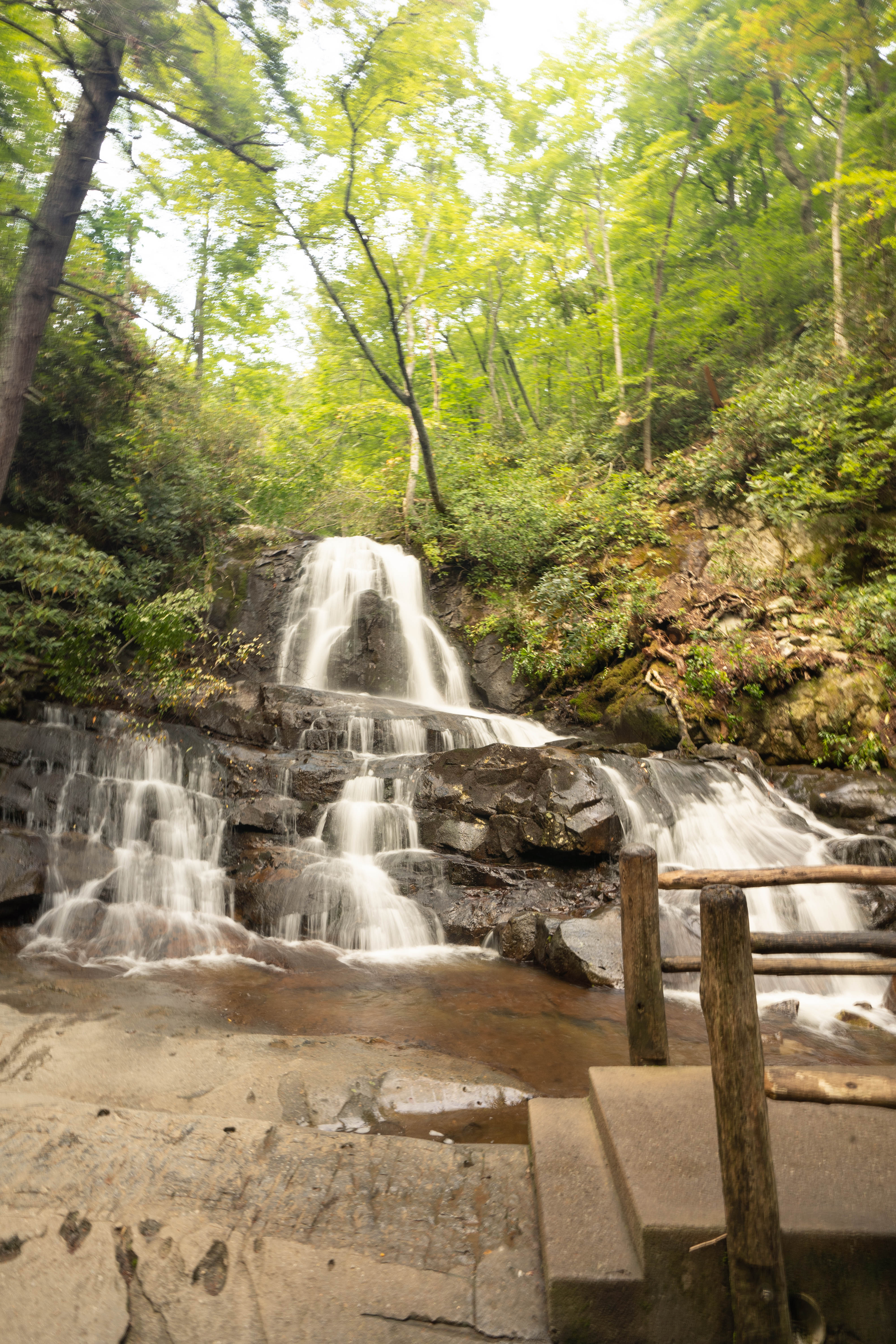
9. Laurel Falls Trail
- Length: 2.6 miles round trip
- Elevation Gain: ~400 feet
- Trail Type: Easy
- Alltrails link: https://www.alltrails.com/trail/us/tennessee/laurel-falls–2
- Laurel Falls Trail is closed as of Jan. 6, 2025 for 18 months of rehabilitation work
Laurel Falls is one of the most popular, beginner-friendly, and best hikes in the Smokies. The trail is paved and just 2.6 miles round-trip, with a gentle incline that makes it accessible for families, newer hikers, or anyone looking for an easy adventure with a big reward.
You’ll follow a shaded path lined with mountain laurel and rhododendron (especially beautiful in late spring), before reaching the highlight of the trail—an 80-foot, two-tier waterfall that flows right under a footbridge. It’s the perfect spot to snap a photo, sit for a minute, and take in the sound of the water.
This trail gets busy, especially mid-day, so plan to go early in the morning or closer to sunset if you want a quieter experience and softer light for photos. If you’re craving more mileage, you can keep hiking past the falls—though the pavement ends here—and continue on toward Cove Mountain, which adds several more miles and a lot more elevation.
10. Chimney Tops Trail
- Length: 3.5 miles round trip
- Elevation Gain: ~1,400 feet
- Trail Type: Strenuous but short
- Alltrails link: https://www.alltrails.com/trail/us/tennessee/chimney-tops-trail
Chimney Tops Trail is short in mileage but steep in effort, and it delivers some of the most dramatic views in the Smokies. The trail is roughly 3.3 to 3.5 miles round‑trip, with about 1,400 feet of elevation gain gained over its steep second half—earning it a spot among the best hikes in the Smokies for those looking for a quick but intense climb.
You begin by following Road Prong Creek, crossing several footbridges as the path climbs gently through hardwood forest. Once you reach the junction with Beech Flats Cove Trail, about halfway in, the real workout begins: over 350 stone steps and nearly 300 locust-log stairs help you power your way up the steep terrain in under a mile.
At the top, you’ll reach an observation platform built below the actual rock pinnacles, created after the 2016 wildfires made the original summit unsafe. From this approved viewpoint, you’ll have expansive views of Mount LeConte, distant ridgelines, and the valleys below.
Most hikers complete the round-trip in 2–3 hours, depending on pace and stopping to soak in the views. The trail draws crowds, so aim for early morning or late afternoon hikes to avoid the crowds and enjoy better light for photos.
11. Grotto Falls
- Length: 2.6 miles round trip
- Elevation Gain: 585 feet
- Trail Type: Easy to moderate
- Alltrails link: https://www.alltrails.com/trail/us/tennessee/chimney-tops-trail
Grotto Falls Trail is high on the list of best hikes in the Smokies. It spans about 2.6 miles round‑trip with roughly 580 feet of elevation gain. The trail starts on the Trillium Gap Trail, and winds through the forest of old-growth hemlocks, spring wildflowers, and small creek crossings.
At around 1.2 miles in, you’ll arrive at Grotto Falls, a 25-foot waterfall with a unique feature. The trail passes behind the cascade, offering a rare spot to feel its mist and hear its roar from behind the curtain of water. Be prepared for slippery rocks and wet footing—but the experience is one of the park’s most memorable.
Most hikers take 2–3 hours to complete the round trip, including pausing at the falls to soak in the atmosphere. If you’ve still got energy, you can hike past the falls. Eventually it reachs Trillium Gap and even Mount LeConte! However, this adds several miles and over 3,000 feet of gain if you choose to continue.
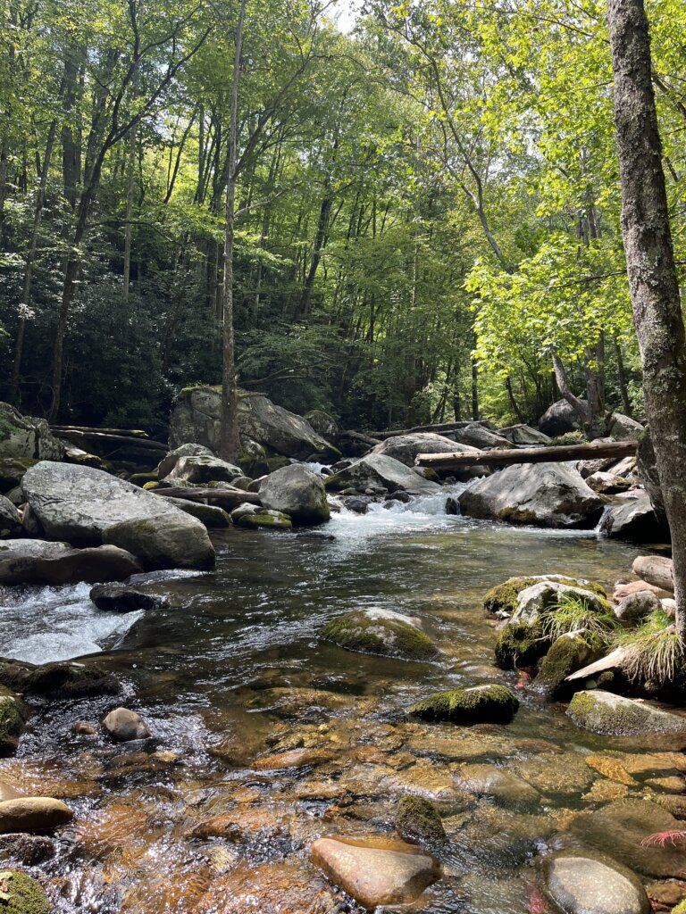
12. Abrams Falls
- Length: 5.2 miles round trip
- Elevation Gain: 675 feet
- Trail Type: Moderate
- Alltrails link: https://www.alltrails.com/trail/us/tennessee/abrams-falls-trail
Abrams Falls Trail is a 5‑mile round‑trip hike in Cades Cove that delivers a powerful waterfall and creekside views with moderate effort—making it one of the best hikes in the Smokies for a half‑day adventure.
You’ll begin by crossing a wooden footbridge over Abrams Creek, then follow the trail as it runs alongside the creek through pine-oak and hemlock forests dotted with rhododendron and wildflowers. There are a few ridge climbs along the way, but nothing too steep—just enough to get your legs moving.
At about 2.5 miles, you’ll reach Abrams Falls. A 20-foot waterfall known less for its height and more for its volume. It drops into a wide, deep pool that often attracts visitors looking to dip their feet or cool off on warmer days.
The round‑trip usually takes 3 hours, or a bit more if you stop at the falls. It can get busy during peak season (thousands of visitors head to Cades Cove daily), so going early or visiting on a weekday helps you avoid crowds.
13. Ramsey Cascades
- Length: 8.0 miles round trip
- Elevation Gain: 2,200 feet
- Trail Type: Strenuous
- Alltrails link: https://www.alltrails.com/trail/us/tennessee/ramsey-cascades-trail
Ramsey Cascades is one of the best full-day hikes in Great Smoky Mountains National Park. It’s perfect for old-growth forest, creekside views, and a waterfall payoff.
This 8-mile round-trip trek climbs over 2,100 feet, averaging about 548 feet per mile. It follows Ramsey Prong through massive untouched hardwood trees. That makes it one of the best hikes in the Smokies for waterfall lovers and experienced hikers.
The first 1.5 miles follow an old gravel road. The path is wide and easy, passing rushing water and frequent stream crossings. After that, the trail narrows and climbs steadily. You’ll pass moss-covered rocks, wild rhododendron, and blooming spring wildflowers.
The final mile is rocky and steep. You’ll cross several footlog bridges and scramble over roots and boulders. Ramsey Cascades is the tallest waterfall in the park, measuring about 100–105 feet. It drops into a clear pool filled with salamanders.
Expect the hike to take 5–7 hours round-trip, but time depends on how long you spend at the waterfall. Parking fills early at the Greenbrier trailhead, so arrive before crowds or consider using a shuttle.