

Summary: Best Hikes near Asheville NC
If you’re planning a hiking trip to Asheville, you’re in a really good spot. Some of the best hikes near Asheville, NC are just a short drive from downtown, and a lot of them feel much more remote than they actually are. Thanks to the Blue Ridge Parkway, you can go from morning coffee in town to a mountain overlook or waterfall without committing to a long drive.
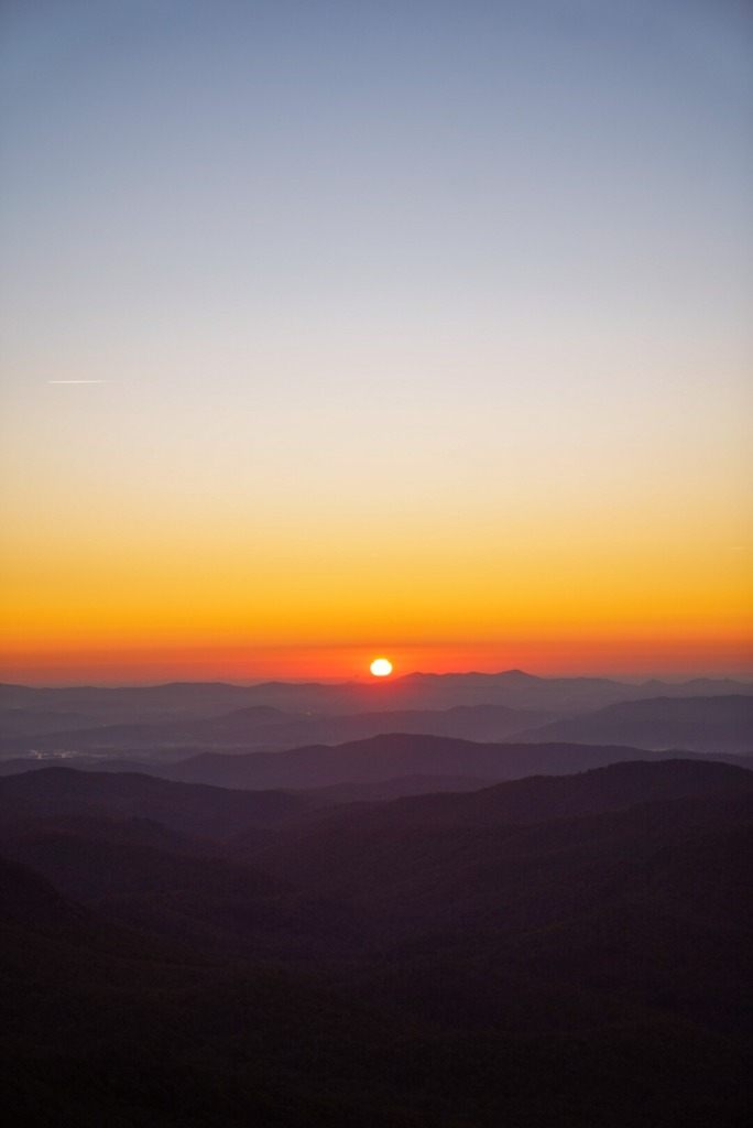
This guide highlights the best hikes near Asheville, NC that are actually worth your time. Think beautiful views, waterfalls, and trails that feel adventurous without being complicated. From quick overlooks to full days exploring Pisgah National Forest and DuPont State Recreational Forest, these are the hikes I’d recommend.
Drive times below are rough estimates from downtown Asheville and can change with traffic + Blue Ridge Parkway conditions.
Quick picks (if you don’t want to scroll)
- Short + scenic: Craggy Pinnacle, Rattlesnake Lodge
- Waterfalls: Catawba Falls, Moore Cove Falls, DuPont Waterfalls Loop
- Best views: Black Balsam Knob, Mount Pisgah, Graveyard Fields
- More of a workout: Looking Glass Rock, John Rock
- Big challenge: Mount Mitchell Trail
Best Hikes near Asheville Overview
| Hike | Best For | Distance (RT) | Elevation Gain | Difficulty | Drive from Asheville |
|---|---|---|---|---|---|
| Craggy Pinnacle | Quick overlook views | 1.4 miles | ~250 ft | Easy–Moderate | 30–40 min |
| Rattlesnake Lodge | Forest + historic ruins | 3.1 miles | ~650 ft | Moderate | 25–35 min |
| Catawba Falls | Large waterfall payoff | 3.6 miles | ~500 ft | Moderate | 35–45 min |
| Moore Cove Falls | Easy waterfall hike | 1.3 miles | ~250 ft | Easy | 50–60 min |
| Graveyard Fields | Waterfalls + meadows | 3.2 miles | ~600 ft | Easy–Moderate | 55–65 min |
| Mount Pisgah | Classic summit views | 2.6 miles | ~800 ft | Moderate | 35–45 min |
| Black Balsam Knob | Wide-open bald views | 1.5 miles | ~450 ft | Moderate | 70–90 min |
| Sam Knob | Bald summit views | 2.3 miles | ~550 ft | Moderate | 70–90 min |
| Looking Glass Rock | Big granite summit | 6.4 miles | ~1,700 ft | Moderate–Hard | 55–65 min |
| John Rock | Forest + cliff views | 5.0 miles | ~1,100 ft | Moderate | 55–65 min |
| Triple Falls (DuPont loop) | Waterfall trio | 3.5 miles | ~500 ft | Easy–Moderate | 60–75 min |
| Mount Mitchell Trail | Bucket-list summit | 11+ miles RT | ~3,600 ft | Strenuous | 55–75 min |
| Hawksbill Mountain | Short hike, big views | 2.0 miles | ~700 ft | Moderate | ~1 hr |
| Fryingpan Mountain Lookout Tower | Fire tower views | 1.5 miles | ~700 ft | Moderate | ~1 hr |
| Waterrock Knob | Quick Parkway stop | 1.2 miles | ~400 ft | Easy–Moderate | ~45 min |
| Crabtree Falls | Waterfall loop hike | 2.5 miles | ~600 ft | Moderate | ~1 hr |
Map of the Best Hikes in Asheville
Quick & Easy View Hikes near Asheville
Craggy Pinnacle
Distance: 1.2 miles RT
Elevation: ~250 ft
Craggy Pinnacle is one of the best hikes near Asheville, NC if you want a short trail with a really good overlook at the top. The incline is steady but manageable, and it doesn’t take long to reach the viewpoint. It’s a good option if you’re newer to hiking, visiting with family, or fitting something in between other plans.
Since it’s right off the Blue Ridge Parkway, the parking lot is small and fills up quickly on weekends. Going earlier in the day usually helps.
Rattlesnake Lodge
Distance: 3 miles RT
Elevation: ~600 ft
Rattlesnake Lodge is one of the best hikes near Asheville, NC if you like a trail with a little history. The path takes you through the woods and leads to the stone ruins of what used to be a summer home. It’s a steady climb, but manageable, and the ruins at the top make it feel different from a typical forest hike.
This area has had storm damage in the past, so it’s a good idea to check trail conditions before heading out, especially after heavy rain.
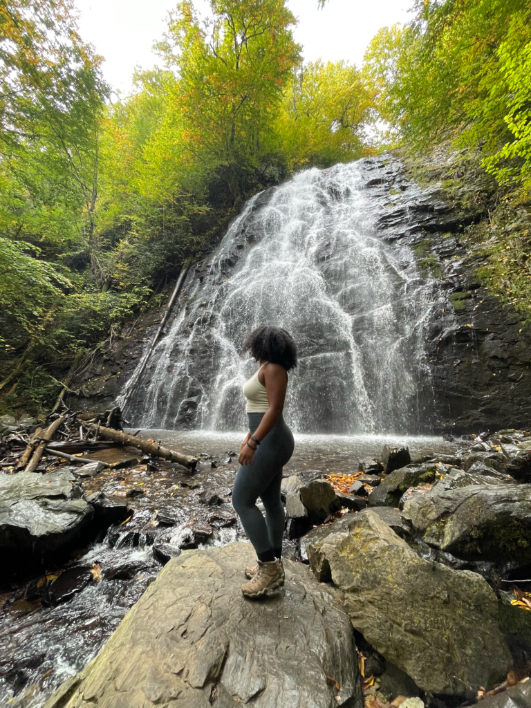
Waterfall hikes near Asheville
Catawba Falls
- Distance: 3.5 miles RT
- Elevation: ~465 ft (plus stairs if you go beyond the lower falls)
Catawba Falls is a good option if you want a waterfall hike that’s not far from Asheville. The trail follows along the river and leads to a wide waterfall at the end. It’s steady but manageable, and the path is easy to follow.
If you continue past the lower falls, the upper section includes a long staircase. It’s doable, but it’s definitely more effort than the first part of the hike, so just plan for that going in.
Moore Cove Falls
- Distance: ~1.3 miles RT
- Elevation: ~183 ft
Moore Cove Falls is a short hike near Asheville that leads to a waterfall you can walk behind. The trail is mostly flat and easy to follow, which makes it a good option if you don’t want anything strenuous.
It’s a popular stop, especially on weekends, so going earlier in the day usually makes it a better experience.
DuPont State Recreational Forest Waterfalls Loop (Hooker + Triple + High Falls)
- Distance: varies by route (roughly 3–4.5 miles is common)
If you want to see more than one waterfall in a single hike, this DuPont loop is a solid option. The route connects Hooker Falls, Triple Falls, and High Falls without needing to move your car, which makes it easy to do all three in one trip. The trails are well marked and manageable, even if everyone in your group hikes at a different pace.
DuPont is popular, especially on weekends and during peak seasons, so getting there earlier in the day or visiting on a weekday usually helps.
Crabtree Falls

Crabtree Falls is a loop hike that gives you a waterfall early on, then continues through the forest before bringing you back around. You’ll reach the falls fairly quickly, and the rest of the trail adds a bit more elevation as you complete the loop. It’s steady but manageable for most hikers.
After rain, parts of the trail can get slick, especially near the waterfall, so just watch your footing.
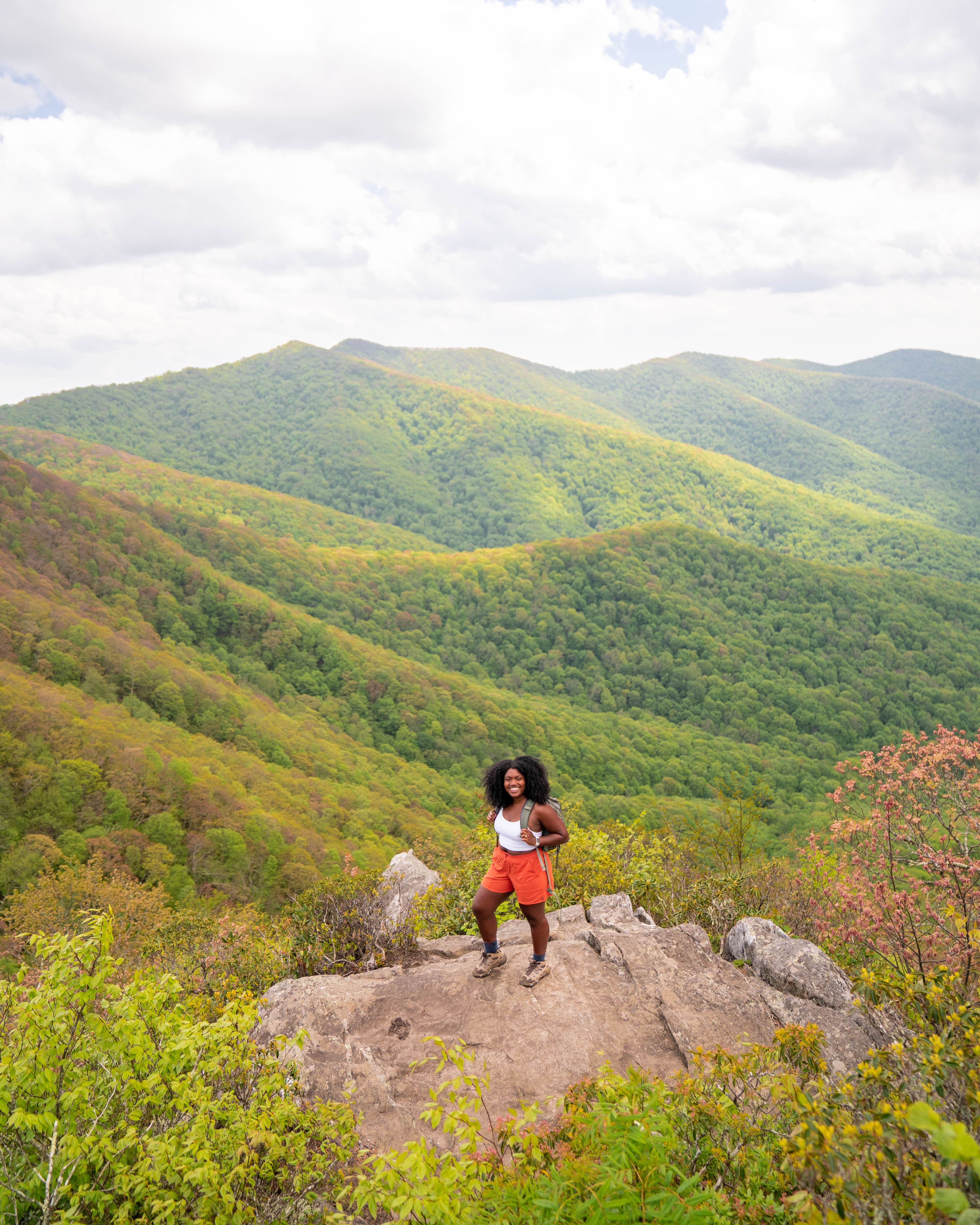
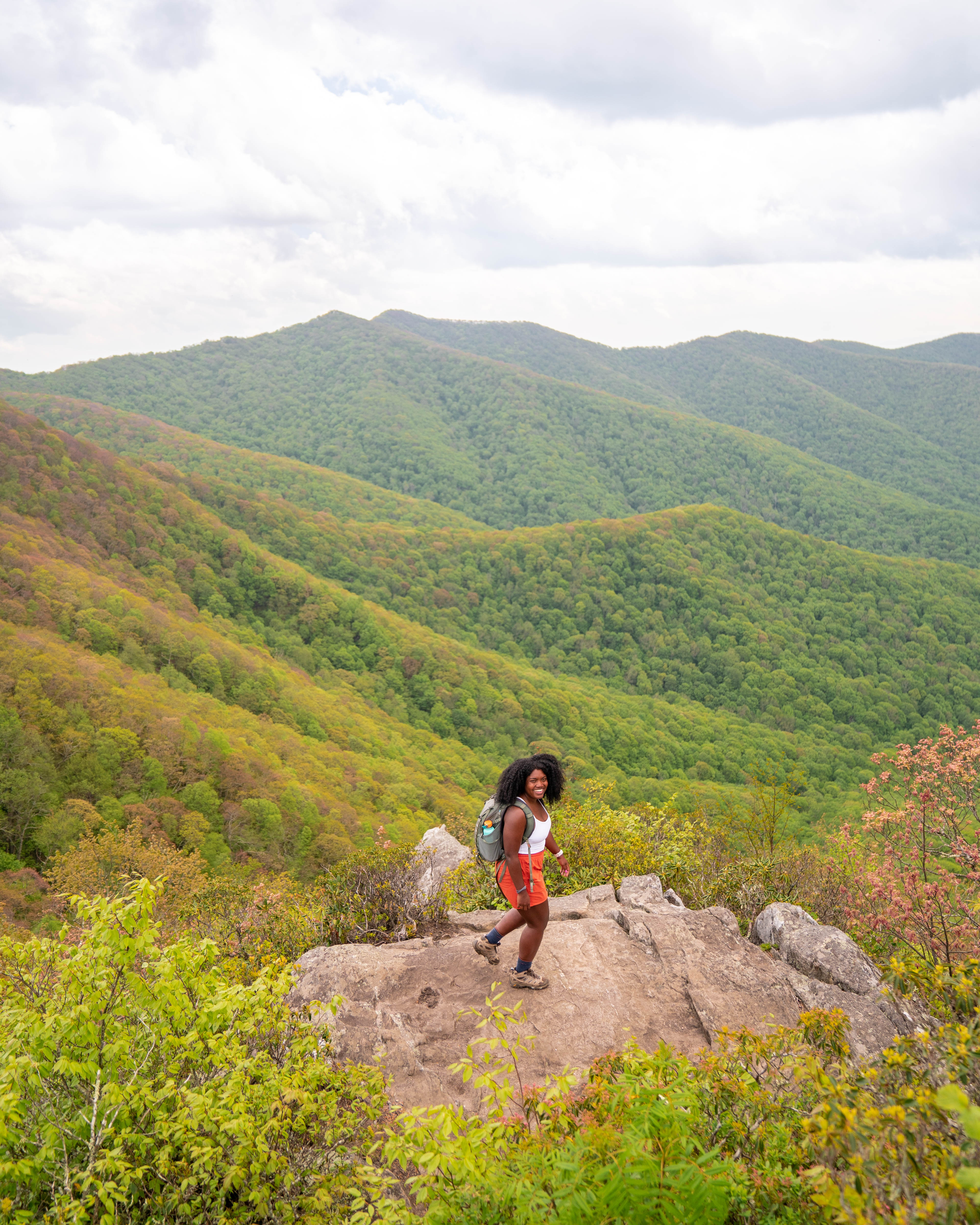
Mountain-view hikes near Asheville
Mount Pisgah
- Distance: 2.6 miles RT
- Elevation: ~750 ft
Mount Pisgah is one of the best hikes near Asheville NC if you want a steady climb with a summit at the top. The trail goes uphill the majority of the way, so expect your heart rate to go up, especially toward the end. On a clear day, the views from the top make the climb worth it.
It’s a popular trail, so parking fills up quickly, especially on weekends. Getting there earlier in the morning or going on a weekday usually helps.
Black Balsam Knob
- Distance: the quick version is short; loops can turn this into a longer day
Black Balsam Knob is one of the best hikes near Asheville NC if you want open mountain views for most of the trail. Since it’s a bald summit, you’re exposed for much of the hike, which means you get views almost the entire time. You can keep it short by going straight to the summit, or extend it by connecting to other nearby trails.
Parking is usually the biggest challenge here, especially on clear weekends. Getting there earlier in the day helps.
Sam Knob
- Distance: 2.5 miles RT
- Elevation: ~570 ft
Sam Knob is a moderate hike with open views near the summit. The trail includes a steady climb, and once you reach the top, you’re mostly on exposed terrain instead of forest. It feels different from hikes closer to Asheville because you’re out in the open for much of it.
Since this area sits at a higher elevation, the weather can change quickly, so bringing layers is a good idea.
Graveyard Fields
- Distance: roughly 3.2–3.5 miles depending on your route
Graveyard Fields is a good option if you want waterfalls and open mountain views in the same hike. You can keep it shorter by visiting just the lower falls, or do the full loop to see both waterfalls and the meadow sections. It’s easy to choose a route based on how much time you have.
Since it’s right off the Blue Ridge Parkway, road access depends on weather and seasonal closures, especially in winter. It’s always a good idea to check Parkway conditions before heading up.
Hawksbill Mountain
Hawksbill Mountain is a shorter hike with a steady climb and a rocky overlook at the top. It doesn’t take long to reach the summit, and the views are especially good on a clear day.
It’s a popular trail, so parking can fill up quickly. Getting there earlier usually helps.
Frying Pan Tower

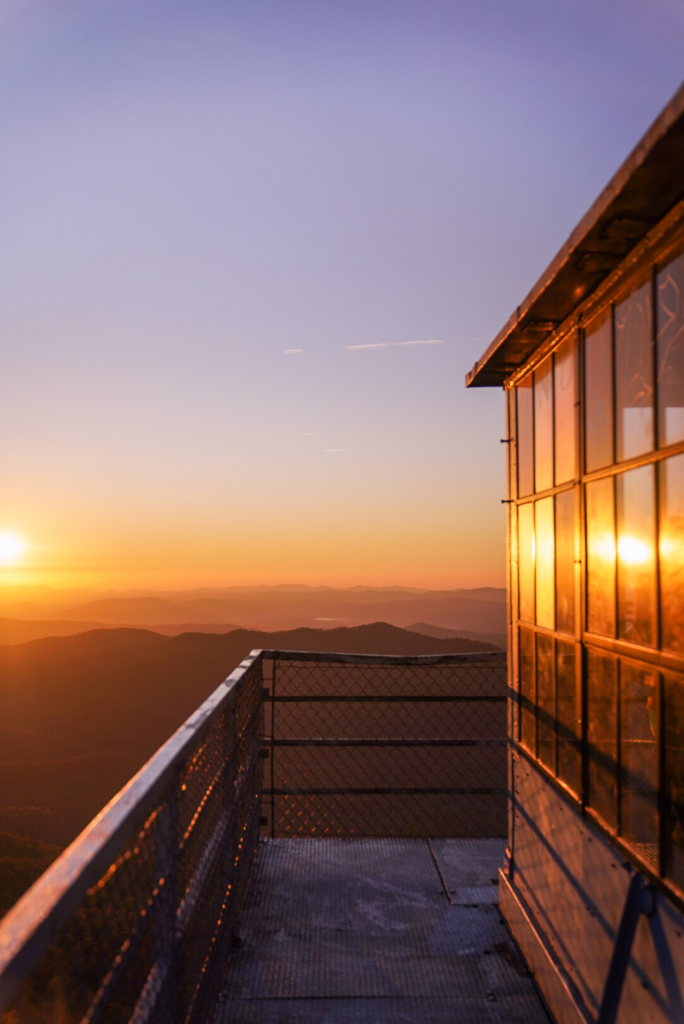
Fryingpan Tower is a steady uphill hike that leads to a historic fire tower at the top. Once you reach the tower, you can climb up for wide views in every direction. The incline is consistent, so expect a bit of effort on the way up.
Since it’s at a higher elevation, the weather can change quickly. Bringing layers and checking conditions before you go is a good idea.
Need help finding layers? My favorite layering pieces are the REI rain jacket, FP movement pants, Darn Tough socks.
Waterrock Knob
Waterrock Knob is a short hike with a steady climb and open views near the top. The trail goes uphill right away, but it doesn’t take long to reach the summit. On a clear day, you’ll have wide views of the surrounding mountains.
It’s a popular stop along the Blue Ridge Parkway, so parking fills up quickly when the weather is nice. Getting there earlier usually helps.
Moderate-to-challenging hikes
Looking Glass Rock
- Distance: ~6.4 miles RT
- Elevation: ~1,649 ft
Looking Glass Rock is an all-uphill hike that takes some effort, especially toward the top. It’s a longer climb, so pacing yourself makes a difference, particularly on warmer days. Once you reach the summit, you’ll be standing on a large rock face with wide views of Pisgah.
Bringing extra water and starting earlier in the day is a good idea, especially if you want parking and a little more space at the top.
John Rock
- Distance: roughly 4.8–5.7 miles depending on the route you take
- Elevation: roughly 1,062–1,255 ft
John Rock is a longer hike with a steady climb and a rock overlook near the top. The trail moves through the forest, includes a few creek crossings, and gradually gains elevation before reaching the viewpoint. It takes more time than the shorter overlooks, but it’s still manageable if you pace yourself.
After rain, sections of the trail can be slick, especially on the way down, so good shoes and taking your time help.
Mount Mitchell Trail
- Distance: 5.7 miles one way
- Elevation: ~3,630 ft
Mount Mitchell Trail is one of the best hikes near Asheville NC if you’re looking for a serious climb. It gains a lot of elevation over a long stretch, so this isn’t something you casually add to your day. It’s better planned as its own outing.
Bringing plenty of water and snacks is important, and it helps to think through timing before you go. Since you’re gaining elevation the whole way up, temperatures at the top can feel noticeably cooler than in town.
Seasonal + logistics tips (that save you headaches)
Before heading out, there are a few things to keep in mind. The Blue Ridge Parkway often has closures in winter weather, so it’s always worth checking road conditions before you drive up. Parking at popular trailheads can also fill up quickly, especially on weekends, so earlier hikes usually make the day easier. Cell service is limited in many areas, so downloading maps ahead of time is helpful. And even if Asheville feels mild, the Parkway can be noticeably colder and windier, so bringing layers is a good idea.
If you’re building your list of the best hikes near Asheville NC, I usually recommend choosing one waterfall hike and one view hike. That combination gives you variety without trying to pack too much into one day.